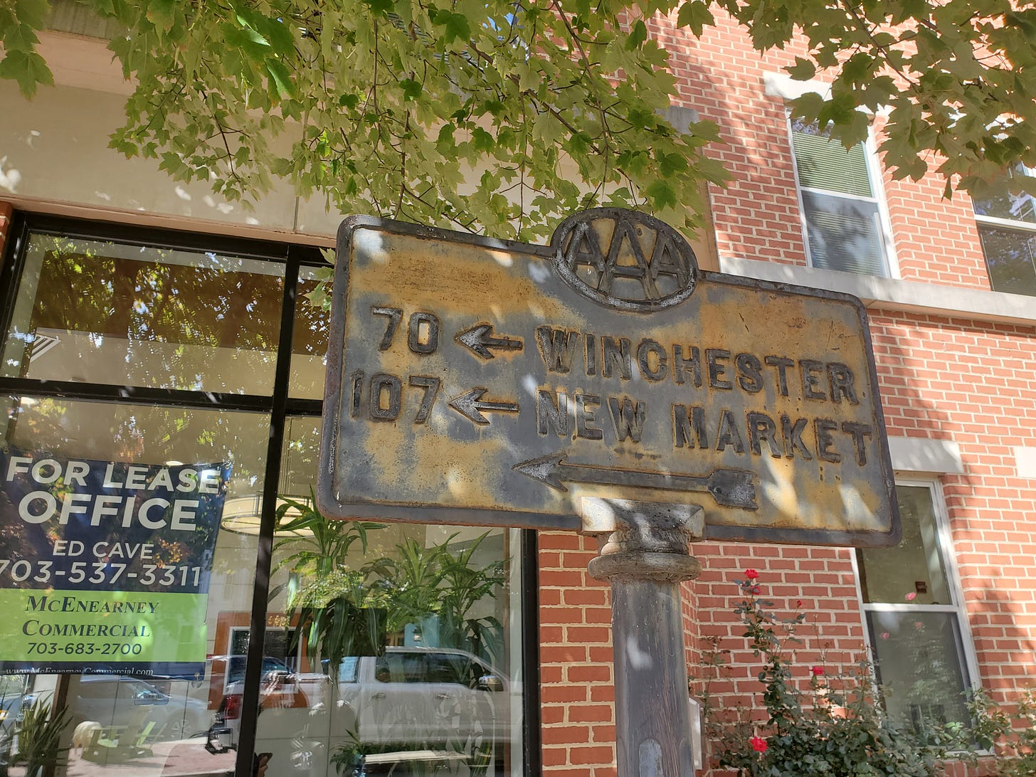
This is an old AAA sign in Old Town Alexandria, Virginia:
I had seen a Facebook post on a Northern Virginia history page about this, and I happened to walk by it the last time I was in Alexandria. I remembered it from that post, and took these photos.
Now it’s partly interesting just because of how old it is, and for the fact that it’s survived all this time despite being basically useless today. But it’s even more interesting for the cities listed on it.
Winchester, if you’re familiar with Northern Virginia, you’ve probably heard of. But New Market? I had never heard of New Market until I drove through it on Route 11. It’s well over an hour from Alexandria, even today (longer back then, when there were no Interstates).
Here’s New Market. It’s basically a rural small town in the Shenandoah Valley.
For the vast majority of people in Alexandria, New Market is not “on the map.” So using it as a marker—along with Winchester, which is also mostly outside of the D.C. metro area—is interesting to me. (The sign is a block from King Street, which is Route 7, which runs to Winchester from Alexandria. So that makes a lot of sense.)
One commenter wrote: “This is awesome. I live in New Market (right on 211, as a matter of fact!). Not many modern northern Virginians would know where that is. Come out and pay us a visit. Luray Caverns is less than 20 minutes from us. Thanks for the shout out!”
Another wrote, “Where I live in Middleburg — it is so named because it is halfway between Alexandria and Winchester along Ashby Gap trading route.”
People were checking whether the distance quoted was accurate (it’s hard to be sure because some of the road alignments have changed), and speculating when the sign was from (pre-Interstate, maybe 1940s.) And one person linked to this Washington Post story about old road signs!
Many commenters were puzzled why the small town of New Market made it on the sign, but here’s a good possible explanation:
Could be that it’s also meant for general directional information too. There was no I-81 back then, and the sign gives you enough info to know that you can get to the Valley & go north in the direction of Winchester or south in the direction of New Market. Who knows why they picked New Market.
And this elaborates on that:
Both Winchester and New Market are where US Highways west out of DC terminated into the great north-south Valley turnpike, US 11.
So who knows why New Market was notable, or if it even was. I find it interesting, though, that while our metro areas have gotten much larger, our sense of geography has possibly shrunken.
It’s easy to forget, sitting in traffic and running around all the time, that most of the places I go are within 30 miles. Your whole world can be 30 miles. Maybe it should be a little bigger.
Related Reading:
Thank you for reading! Please consider upgrading to a paid subscription to help support this newsletter. You’ll get a weekly subscribers-only post, plus full access to the archive: over 400 posts and growing. And you’ll help ensure more material like this!


Possibly linked to the Battle Of New Market? Small Civil War skirmish but pretty big in the lore of VMI as well as part of state culture. If that sign went up in 20s or 30s would have still been in living memory.
I loved your comment about "your whole world can be 30 miles". Growing up in rural KS, my world was certainly larger than 30 miles. It was 30 miles to the nearest center of commerce- groceries, auto parts, etc. There were a couple of mom and pop places that locals knew about which could suffice in an "emergency-only" type of situation. Now that I'm living in a suburban locale, any drive longer than 15 minutes for my kids seems like it's halfway across the state! Time and geography are relative, I suppose. When my kids complain about something being too far, I have to pull out the "Back in my day..." card.