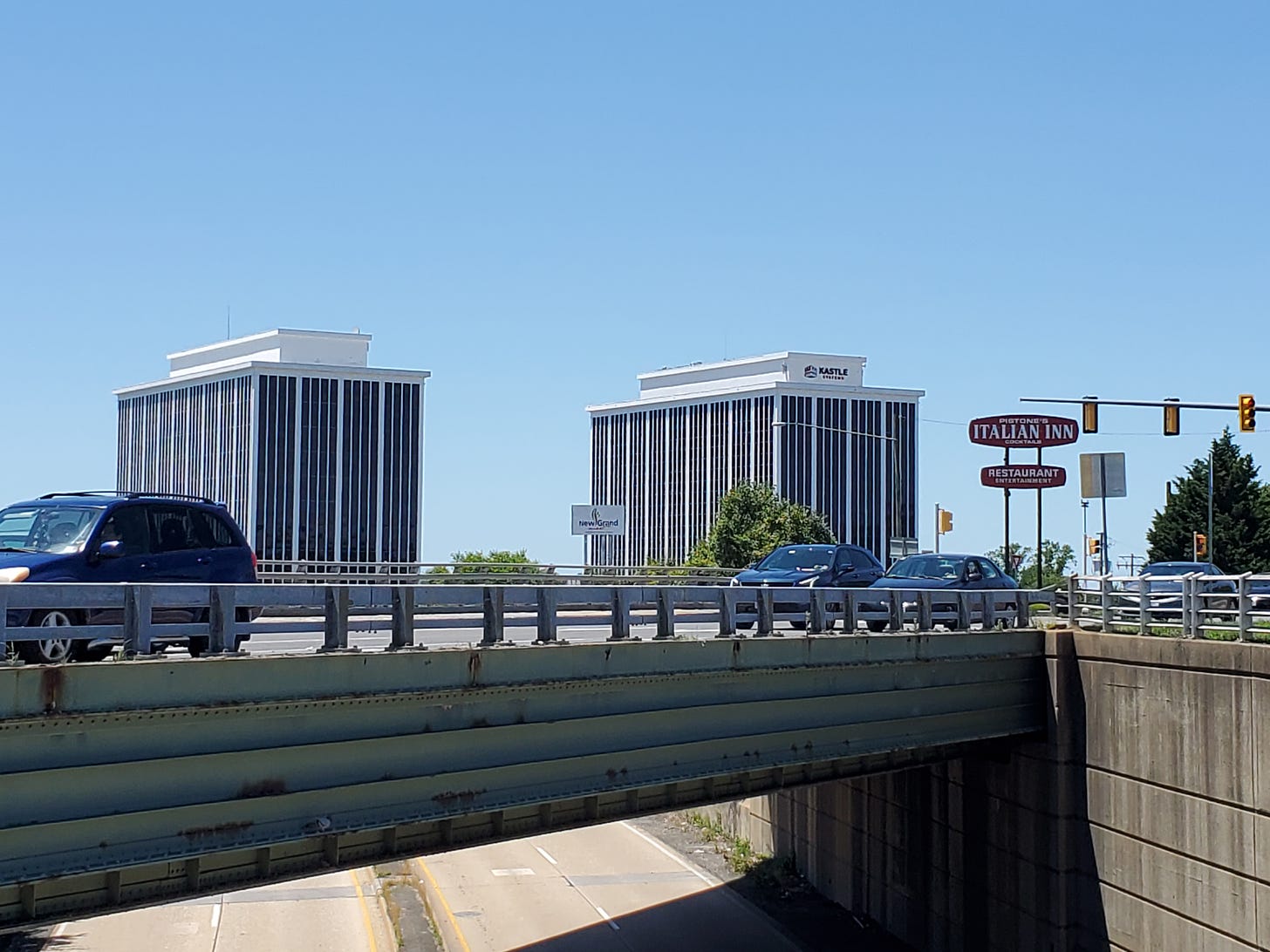
It’s funny that despite my dislike of car dependence and my love of walkable places, the bread and butter of my work is road trips. Two of the pieces I’m proudest of, and had the most fun putting together, were this long drive down U.S. Route 11 through Virginia’s Shenandoah Valley (which yielded the logo for this newsletter!), and this drive on U.S. 50 East from Arlington to Winchester.
It’s the latter piece, which I called “A History of Sprawl In One Road Trip,” that I’m revisiting today. As with any photo essay like this, there’s a limit on how much imagery you can include before it starts to feel like visual clutter. So here are some more photos from this ever-interesting stretch of American highway, with the variation that this time, I was driving east from Fairfax to Arlington.
That changes the whole feel of the drive quite a bit; the mood reverses. Driving away from the city, the traffic and development dissipates, and bit by bit you feel the calmness and openness of the countryside. Driving towards the city, you sense a building energy as the density gradient and scale of development rises.
Here’s how I opened that original essay (well, the literal opening line is further up—I’m rather proud of that too):
While the etiology of sprawl is observable over time—those aerial photos over the years reveal farms turning into subdivisions and country roads into six-lane highways—it is also observable over space. You can study the history of development patterns, but you can also hop in a car and drive down one of the highways along which sprawl has proliferated and, further and further out, is often still proliferating. Consider for a moment what this means: driving away from the city is like going back in time.
Chester H. Liebs, in his landmark book Main Street to Miracle Mile, makes much the same point. It’s sort of obvious and incredibly insightful at the same time—as you travel away from a population center, you’re seeing something like a fossil record of the built environment in different phases.
You might think the fact that outer-ring suburbs are newer would reverse this. To some extent, maybe, it does. But land values fall further from the city, meaning that whatever older buildings are there last longer, with less redevelopment pressure. And even though outer-ring suburbs are newer, their basic sparse form, and their sometimes-odd mix of countryside and suburban aspects, is really how a lot of much closer suburbs felt when they first developed decades ago.
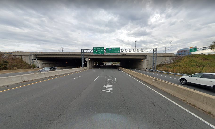
Anyway, since I noted the direction change, I wanted to start with this image, which marks the point in the drive when I first get that excited feeling that I’m going into the city:
This is still Route 50, but this segment is limited access. It’s actually a bit of a false hint; this bit is sandwiched between two pretty long stretches of sprawl. I guess it’s ironic that a freeway-style road reminds me of the city, but it does. The pace and difficulty of the driving increases, and your senses come more alive. (The first real hint that you’re leaving the city takes a lot longer—there’s a point out by Chantilly, where a mile or so of sparse, brand new development gives way to forest, and 50 narrows down to its original two lanes. A few recent subdivisions later, and you’ve reached the exurban edge.)
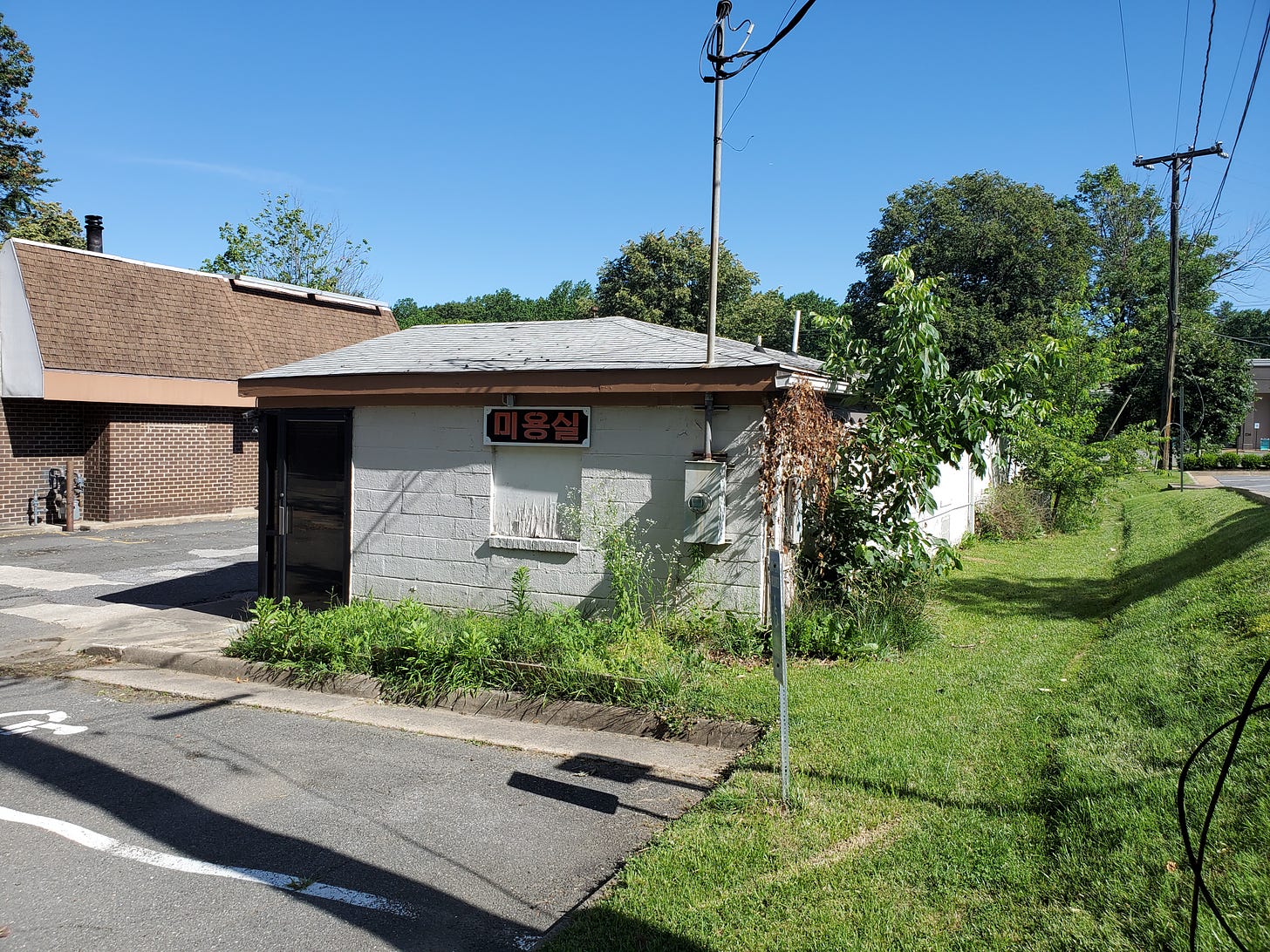
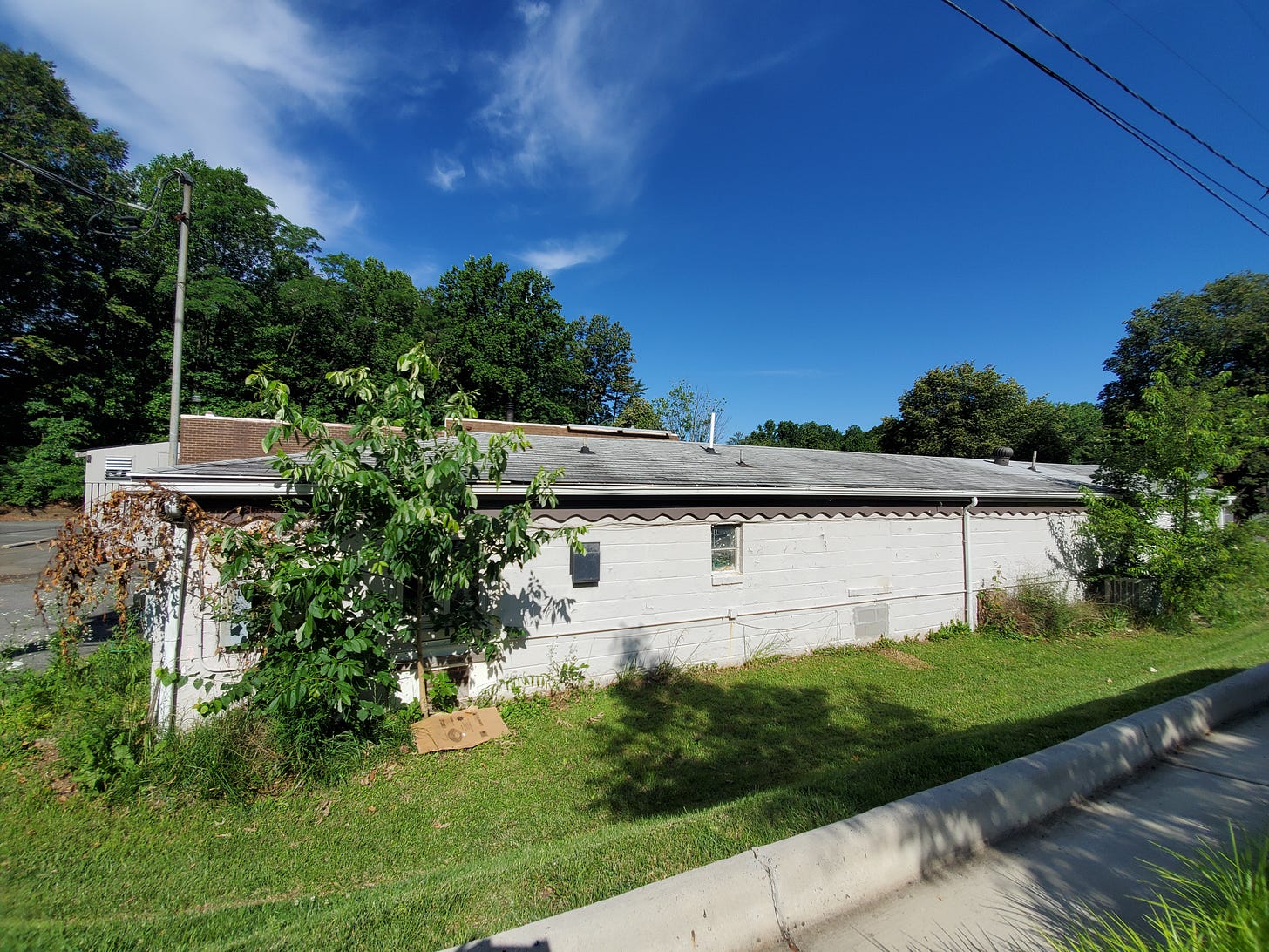
Now, more pictures. Here’s the building I used to inaugurate my What Do You Think You’re Looking At? series. It’s a tiny strip mall—which is actually one wing of an old U-shaped motel! You can see where the back windows, perhaps at one time holding air conditioners, were bricked over. The front has been modified, but the tiny scale of the building is unaltered. It feels really small when you actually walk around it up close.
Nearby, on the other side of the road (I couldn’t get my own photos), are these two surviving midcentury gas stations, likely Gulf or Texaco models. They’re a bit run down, and neither is still a gas station, but they are quite well intact. These drives can feel like scavenger hunts for stuff like this.
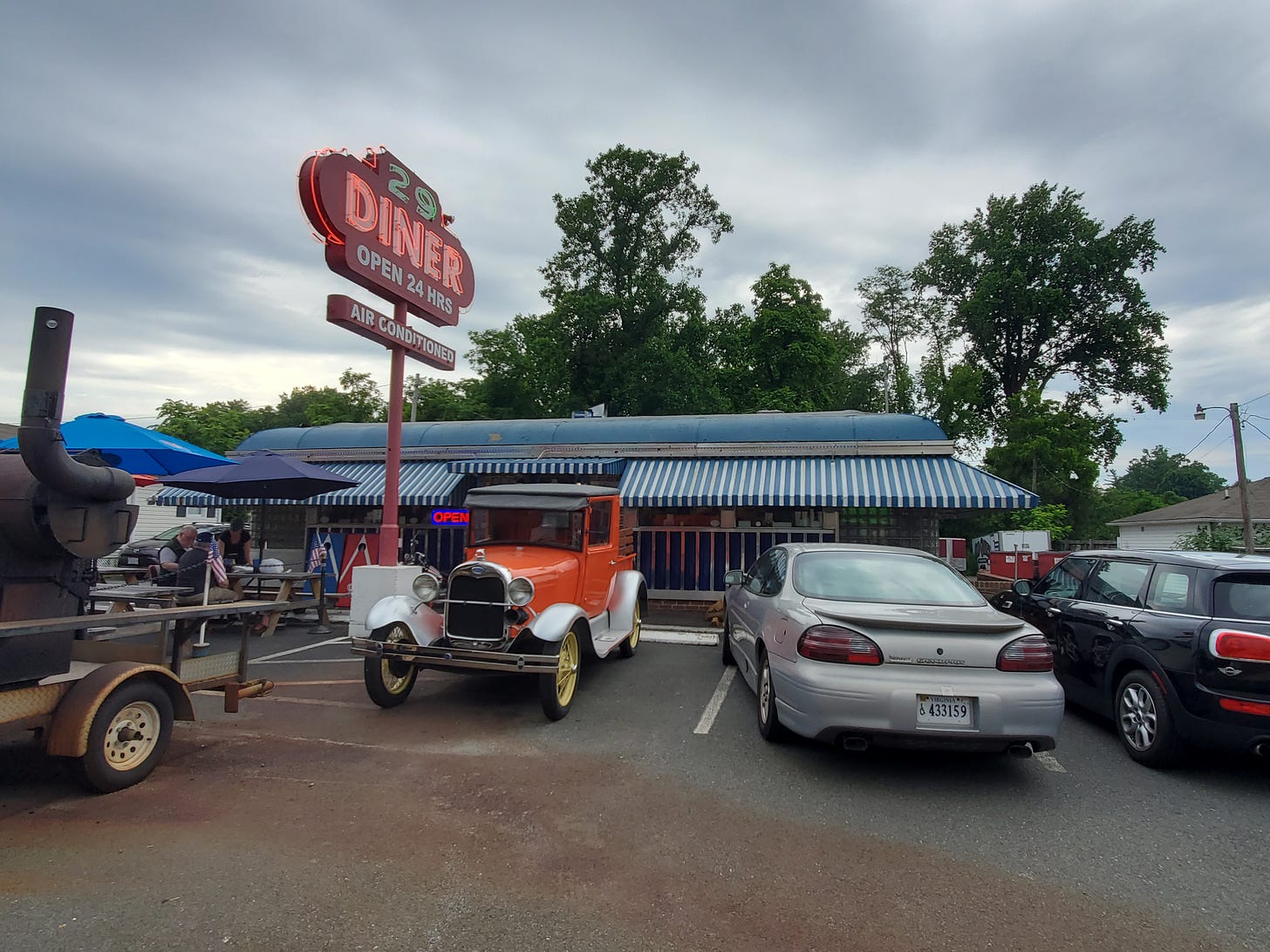
Also right along here is the famous 29 Diner (this stretch is numbered both 50 and 29). I haven’t eaten there yet, but it’s very much on my list. It is the only surviving diner of several that once lined Route 50 in Fairfax.
One of them, however, survived until 2018, hidden behind a Mexican-themed façade. This seeming strip mall, now demolished, consisted of a totally encased chrome diner with a banquet room added on, modified into two storefronts. You have to take a look at this. Believe it or not, the same thing is going on with the also-nearby Fairfax Toyota dealer, which contains a classic 1940s single-screen movie theater! Who knows how many ordinary-looking buildings are actually like this?
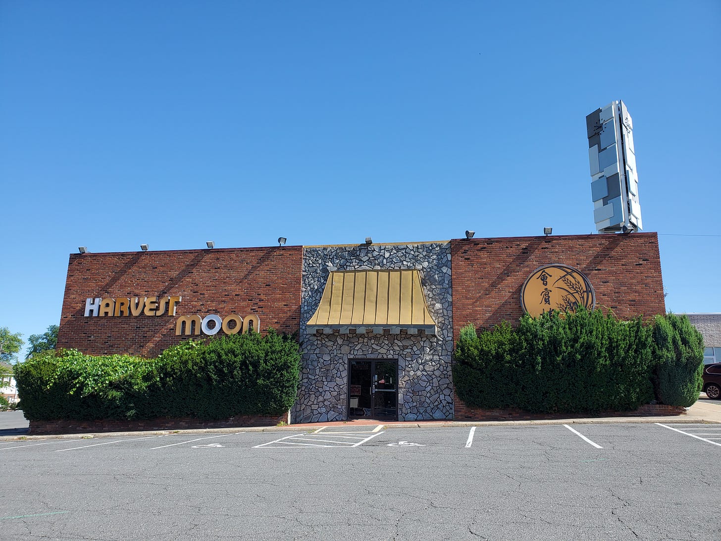
I wanted to have lunch at the next place here, but unfortunately it’s currently closed. It was open two months ago; perhaps the labor shortage has it temporarily closed, or perhaps it held on through the pandemic but just didn’t have the funds to enjoy the reopening. Despite pretty poor reviews, it’s a neat, very retro Chinese restaurant that also doubles as a wedding and event hall. They used to offer a basic, old-fashioned buffet, too. It’s one of those places I always wanted to try and never got around to. I hope I still can.
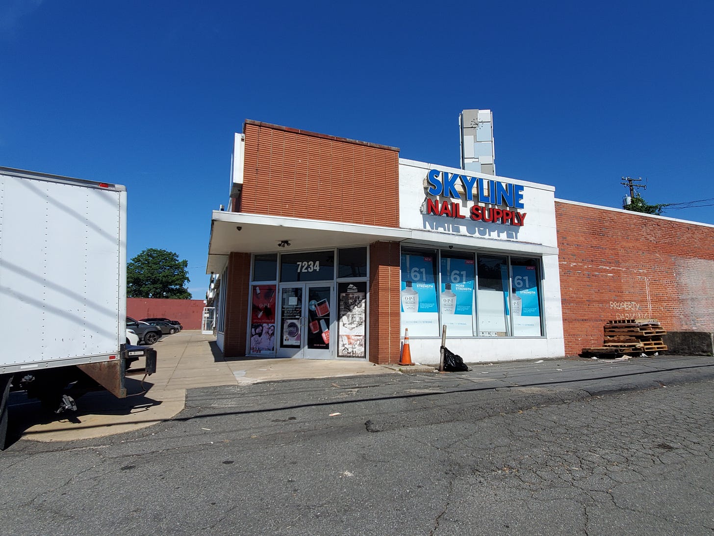
It’s attached to an early strip mall; the space probably began as an anchor store. The strip, including what’s now Harvest Moon, dates to at least 1953, according to Fairfax County’s excellent online aerial imagery database. Take a look at this store at the other end of the strip—it’s styled like an urban corner store! It’s fascinating how early suburban strip malls retained many little details of the urban commercial blocks that are their distant relatives.
Today, the strip mall is home to a handful of mostly immigrant-run businesses. The space isn’t fancy, but it’s affordable. This is one reason I’m not totally enthusiastic about old strip-mall redevelopment. Affordable commercial space is an entrepreneurial resource, especially for those without a lot of cash on hand.
A little further down, check out this set of old houses, built for a narrower and quieter Route 50, which now house businesses.
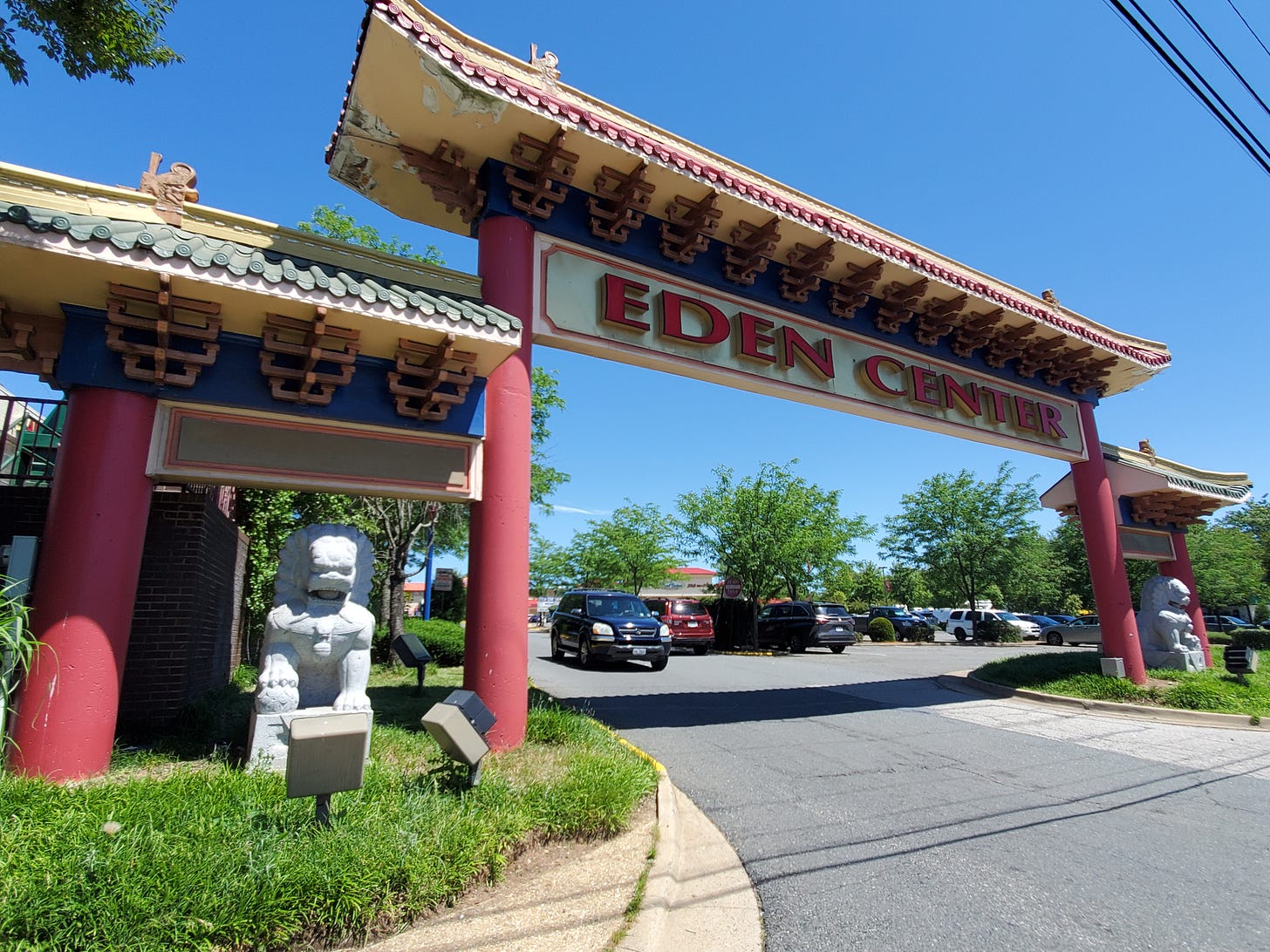
The next really notable thing you’ll see driving east is Eden Center (it isn’t on Route 50, but it’s visible.) Welcome to Seven Corners, a massive intersection where several of the area’s major thoroughfares collide, and where each triangular bit of land between the highways is home to huge strip plazas and retail.
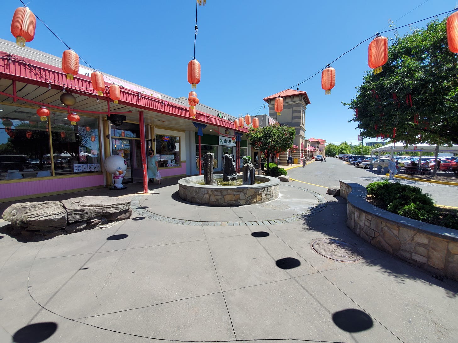
I’m going to do a separate post of Eden Center, but here are a couple of photos. It was an aging strip mall, totally reinvented in the 1980s by the area’s Vietnamese community and transformed into a culinary and cultural anchor. Its largest store, Good Fortune supermarket, began life as a Zayre discount department store!
I snapped this next picture right in the middle of the Seven Corners intersection. It reminds me of something James Howard Kunstler wrote once: that American suburbia almost entirely lacks a skyline. This probably isn’t the kind of thing he was hoping for, but it is a kind of skyline, and there really are very few places where you get this kind of visual variety. Many people find it chaotic and ugly. I don’t.
If you keep driving east, you’ll end up in the heavily built-up part of Arlington right near D.C. That area is interesting for how quickly it transformed from low-rise highway sprawl to something resembling a series of urban neighborhoods. I’ve shown some examples of that shift here and here, in What Do You Think You’re Looking At? posts.
But this post is more of an appreciation for the American highway as an aesthetic and a linear place. You’ll notice that the older development or early sprawl is meaningfully different than the new stuff. The scale is smaller, and whatever land-use regulations were in force in those days were looser, with more flexibility and room for entrepreneurship. For example, consider this 1930s motel, whose website just casually notes that the owner built himself a kitchen off one of the rooms and lived there while he and his wife saved up for a house.
Here’s a good contrast between different varieties of roadside development:

I’ll wind this down here, although there’s almost no limit on how many of these I could write—even just for this corridor! Almost every one of the buildings you pass, and every apartment complex or neighborhood, means something to someone, and has a story.
Related Reading:
Suburban Archaeology: Hobbyists are telling the stories of places historians dismiss
Thoughts on Density and Distance: Car-oriented landscapes can feel very different from each other
If you’ve made it to the end, and you like what you’re seeing, please consider a paid subscription to help support this work. You’ll get a weekend subscribers-only post, plus full access to the archive. And you’ll help ensure more material like this!


