


Don't Destroy The Real One!
What Do You Think You're Looking At? #198

This is an image from the back cover of a Calvin and Hobbes compendium, where Calvin (as Calvin the Giant, from an actual strip) is basically pretending he’s Godzilla after drinking a super-sizing elixir:
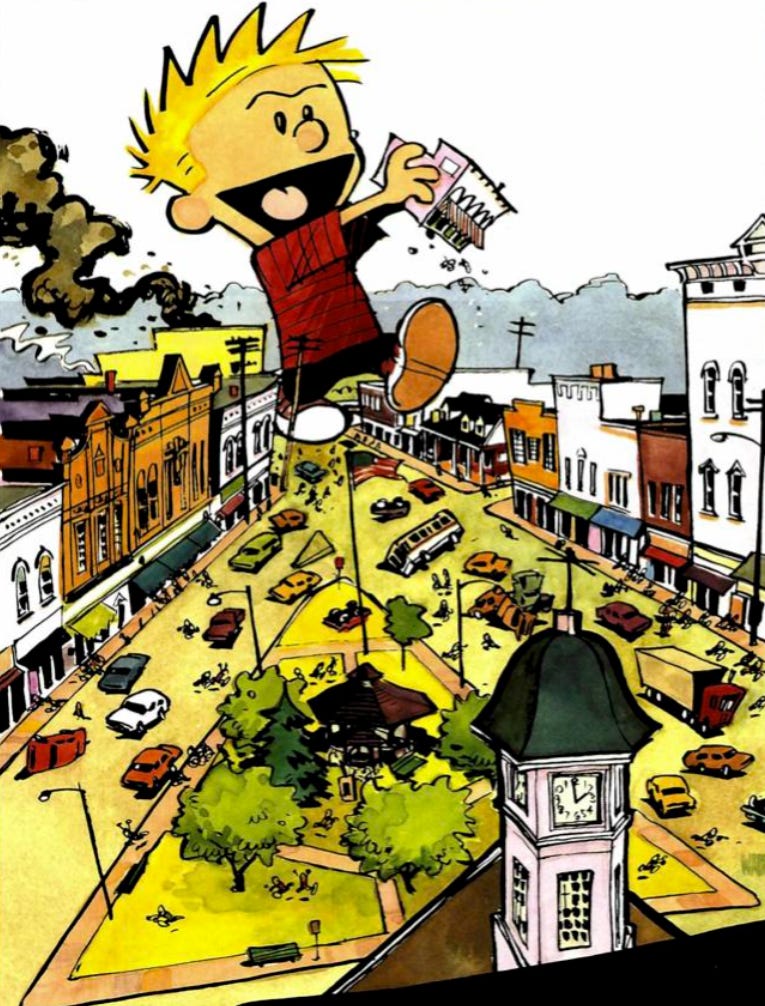
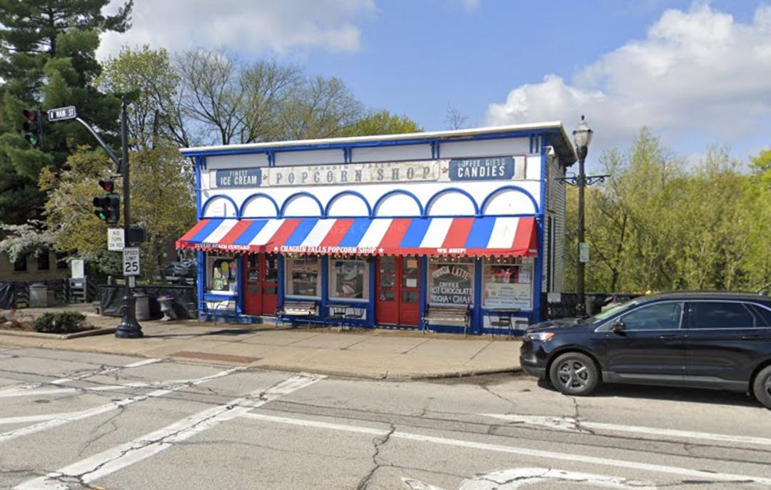
Do you see the building in his hands?
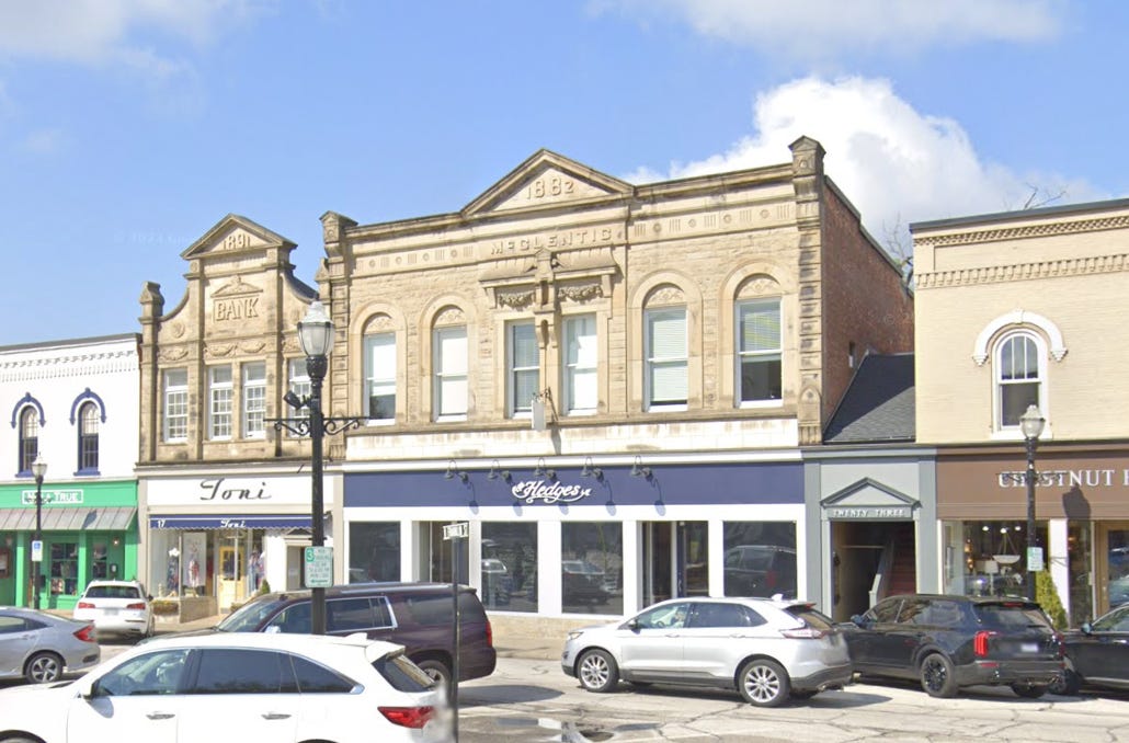
The building on the left with the little triangular facade element in the middle?
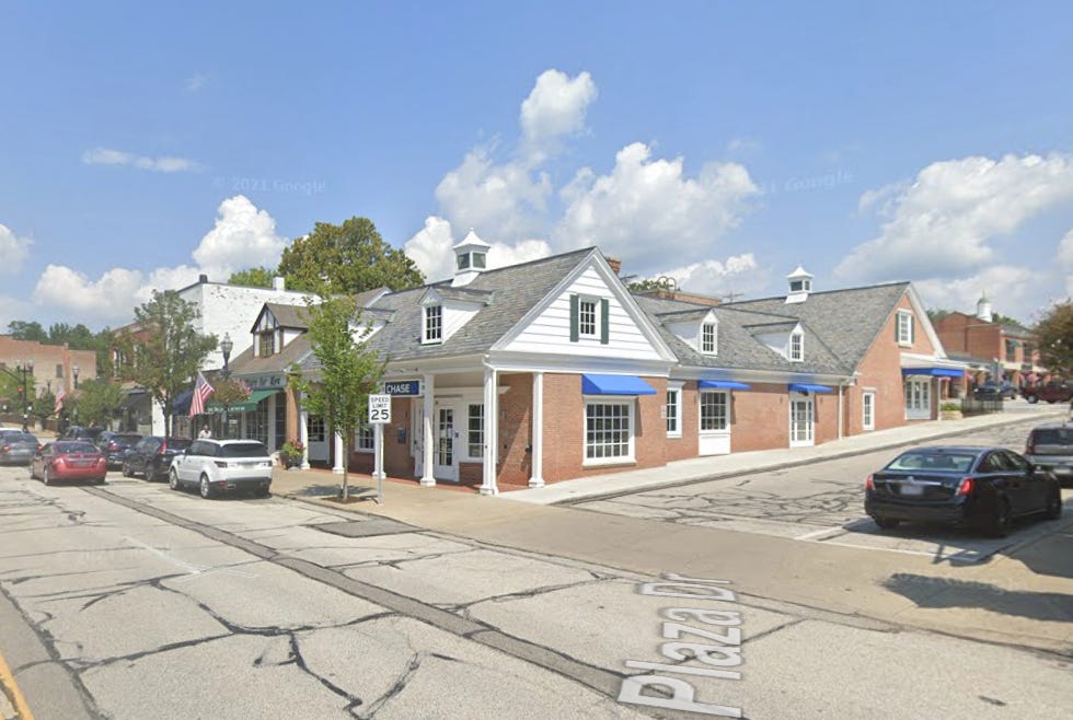
The one under Calvin’s foot that looks like a house?
The whole illustrated town?
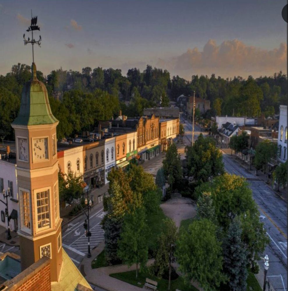
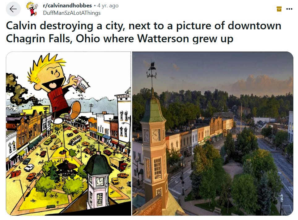
The Calvin and Hobbes collection on which that artwork appears, The Essential Calvin and Hobbes, is from 1988. So this town hasn’t changed, at least in its downtown area, in many decades. (Don’t look now, but 1988 is 37 years ago. So as long ago as World War II, then!) Probably, it looked more or the less the same when Calvin and Hobbes author Bill Watterson was growing up, too.
In that Reddit thread are these fascinating comments:
“Northeast Ohio was settled by the Connecticut Land Company and they laid town squares everywhere and colonial architecture is dominant so there is a lot of similarities to New England.”
“Otherwise known as the Connecticut Western Reserve. Clam bakes are big in Cleveland, and I’ve heard it has its roots in NEO’s former connection to Connecticut.”
That’s really interesting. I’m going to read more about that connection and history.
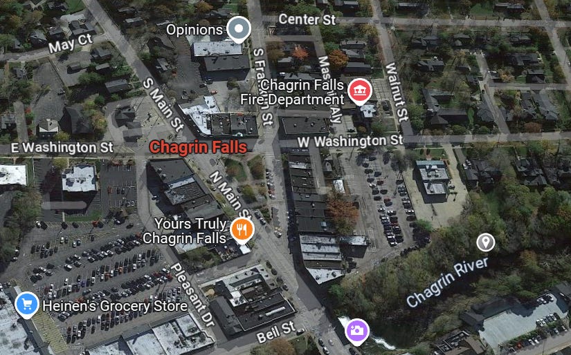
However, this particular town has a much less common town triangle!
You never know what inspires a piece of artwork!
Related Reading:
A Magnificent Liquor Store in High Bridge, NJ
What Do You Think You’re Looking At? #24
Thank you for reading! Please consider upgrading to a paid subscription to help support this newsletter. You’ll get a weekly subscribers-only piece, plus full access to the archive: over 1,100 pieces and growing. And you’ll help ensure more like this!
Are triangles that uncommon? They were a good adaptation to what would otherwise be a T-intersection of two major roads.
The New England-ish town I grew up in had such a triangle, until the state traffic czars decided it would be more efficient to have a T. They were right, if you only considered efficiency as it’s experienced by drivers, but it made it really difficult for pedestrians as there were no longer any safe direct routes from one side of the town centre to another.
It also made for a visual and perhaps psychological disconnect between the various functions: church, town hall, commercial, a bit of residential, all arranged around the triangle of green space with its monument. It had been a place you went to, it became something you drive through.
I had no idea! I grew up not far from here and went to Chagrin Falls often- cool little town!
The "Western Reserve" moniker is all over Northeast Ohio, but few realize that it's because our area was once part of Connecticut! I touched on the abolitionist history of the area in a piece a while back and how that morphed into Southern sympathy as Cleveland industrialized and became more segregated: https://heathracela.substack.com/p/suburban-confederates